Seminole County has 12 tornadoes rated F3/EF3 or stronger in its 1950–2025 record, including three F4s. Its mapped soils include about 37% rated high or very high for shrink-swell.
Three F4s
| Date | Deaths | Injured | Path |
|---|---|---|---|
| September 14, 1957 | 2 | 6 | 67.5 miles, with Cleveland, Hughes and Pottawatomie counties |
| May 4, 1960 | 0 | 0 | 8 miles, with Pottawatomie County |
| May 17, 1981 | 0 | 2 | 33.6 miles, with Okfuskee and Okmulgee counties |
The 1957 tornado is the only deadly one on the county’s record. It came in September. The other two also appear on the Pottawatomie County and Okmulgee County pages. The 1957 path also crossed Cleveland County. Ratings, deaths and injuries are for the whole path.
The recent record
NOAA’s Storm Prediction Center (SPC) lists 11 tornadoes here in 2016–2025. Those recent tracks all had ratings below EF3.
The city of Seminole’s long-range plan, written in 2012, lists tornadoes first among the disasters most likely to hit the region.
Registering a shelter in Seminole
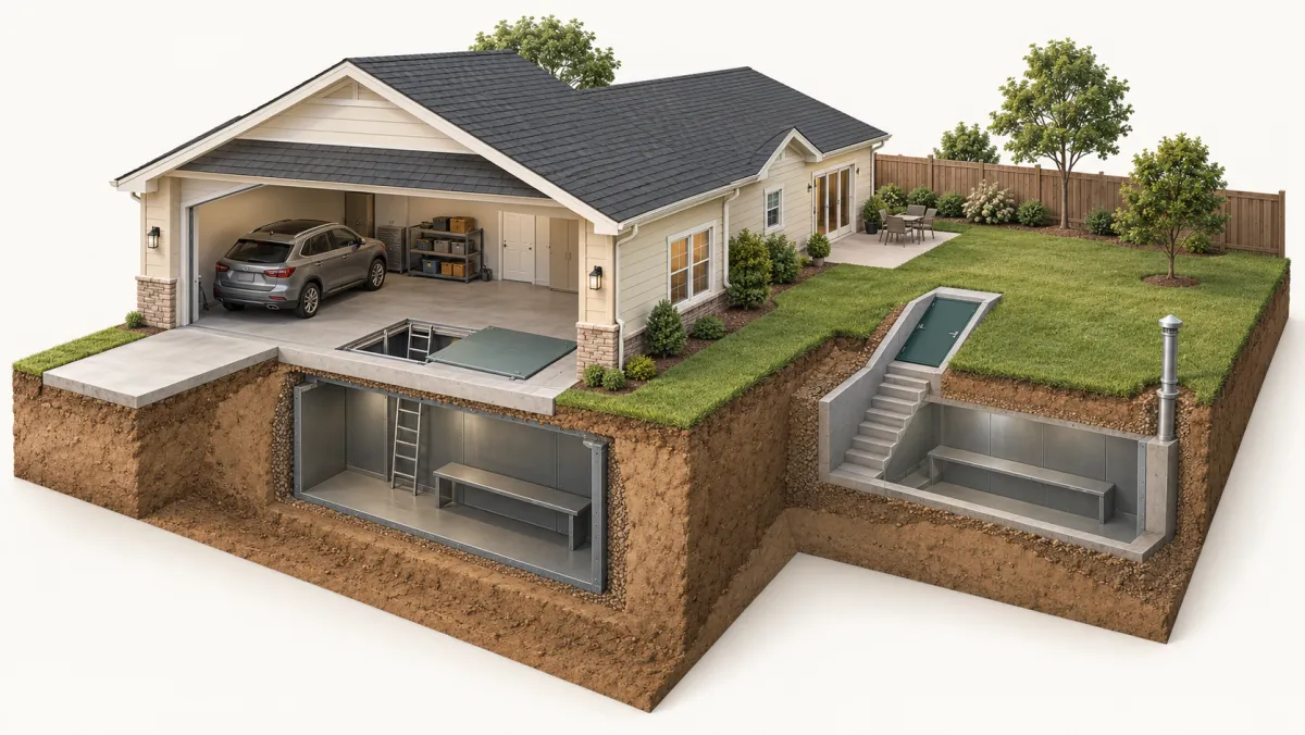
The city of Seminole keeps a storm shelter registry. After a disaster, its emergency teams use the list to check that families can get out of their shelters and are not stuck under debris. You register with the city’s online “Map My Shelter” form. It asks for the shelter type, a pin on a map and how many people it holds. The details are not made public.
Clay in more than a third of the county
About 37% of Seminole County’s mapped land has soils rated high or very high for shrink-swell. This clay changes volume as it takes in water and dries out. Under 1% is very high. Every one of the five biggest high-rated areas has the same swell rating, 7.5%.
The largest shares the county’s name: Seminole, Chickasha and Mulhall soils, 34,796 acres of severely eroded slopes. Niotaze soils on 3–30% slopes add more than 50,000 acres. One high-rated area, the Seminole-Gowton complex, is mapped as frequently flooded. These figures describe the county, not a single yard.
If your lot is low or near a creek, ask each installer how it handles water around an in-ground shelter. For the city, see storm shelters in Seminole and foundation repair in Seminole.
What a free quote should include
Request a quote and ask the installer to see the spot first. Ask for the written price to cover:
- the shelter and its anchoring
- whether the shelter needs a permit, who will pull it and any fee
- digging, dirt hauling and any drainage work
Ask too whether the installer will add the shelter to the city’s “Map My Shelter” registry once it is in. Price ranges are on storm shelter costs in Oklahoma.
Frequently asked questions
How many strong tornadoes has Seminole County had?
The SPC record for 1950–2025 has 63 tornadoes touching the county. Twelve reached F3/EF3 or higher.
What does the city of Seminole's shelter form ask for?
Your name, address and phone numbers, the shelter type (above ground, below ground or in the house), a pin on a map, and how many people the shelter holds. The city says the information is for emergency management use only.
Is a state shelter rebate available in Seminole County?
As of October 2026, the 2026 SoonerSafe rebate round is closed, according to Oklahoma Emergency Management.
Sources
- SPC Severe Weather Database: tornadoes 1950-2025 (NOAA Storm Prediction Center)
- Soil Data Access, SSURGO survey data (USDA NRCS)
- Emergency Management (City of Seminole)
- Storm Shelter Locations (City of Seminole, ArcGIS Survey123 form)
- Seminole 2030 Comprehensive Plan (City of Seminole, April 2012)
- SoonerSafe Safe Room Rebate Program (Oklahoma Emergency Management)